davin.50webs.com/frank
Tararua Antarctic expedition (1962-1963).

Main Menu Mount Pearson Antarctic Expedition
Antarctica Ahoy! Around Scott Base Expedition Begins Exploration Area Exploration Routes
Plateau Loop Map Polar Plateau Icy Panorama East Quartzite Range West Quartzite Range
Upper Glacier Glacier Route Middle Glacier Lower Glacier Final Stretch
Destination Conclusion Diary: Introduction Diary: Preparation Diary: Polar Plateau
Diary: Quartzite Xmas Diary: Into the Glacier Diary: Home Run Appendix: Polar Life Appendix: Logistics
Appendix: Mapping Acknowledgements


Icy Panorama

Nunataks are rock islands in the polar plateau ice. 
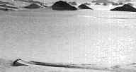
Nunataks forming the West Quartzite Range
dot the plateau 16 km west of survey station H2.

Nearby, "streaming" ice flow past a small nunatak
indicates a slope northwards, towards the Rennick Glacier névé.

Lloyd Icefall tumbles into the Rennick Glacier Névé.

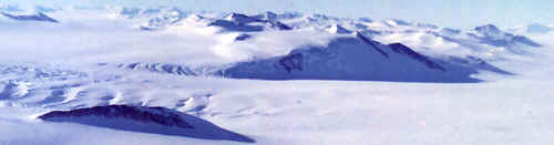
View north from H2 across the Lloyd Icefall, which descends to the Rennick névé.

Rennick Glacier embarks for the Antarctic Ocean. 
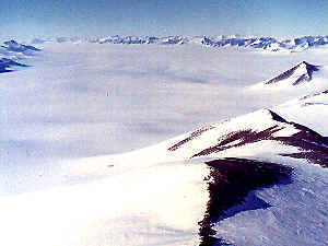
View northeast from H2.

The Rennick Glacier flows north
to the Oates Coast of Antarctica,
which lies south of Tasmania.

East Quartzite Range
Back to Antarctica
| Main Menu | Mount Pearson | Antarctic Expedition | | |
| Antarctica Ahoy! | Around Scott Base | Expedition Begins | Exploration Area | Exploration Routes |
| Plateau Loop Map | Polar Plateau | Icy Panorama | East Quartzite Range | West Quartzite Range |
| Upper Glacier | Glacier Route | Middle Glacier | Lower Glacier | Final Stretch |
| Destination | Conclusion | Diary: Introduction | Diary: Preparation | Diary: Polar Plateau |
| Diary: Quartzite Xmas | Diary: Into the Glacier | Diary: Home Run | Appendix: Polar Life | Appendix: Logistics |
| Appendix: Mapping | Acknowledgements
Last modified: Wed Mar 4 17:41:33 NZDT 2020
Best viewed at 1024x768 or above resolution.
© Copyright 1999-2020 Davin Pearson.
Please report any broken links to