davin.50webs.com/frank
Tararua Antarctic expedition (1962-1963).

Main Menu Mount Pearson Antarctic Expedition
Antarctica Ahoy! Around Scott Base Expedition Begins Exploration Area Exploration Routes
Plateau Loop Map Polar Plateau Icy Panorama East Quartzite Range West Quartzite Range
Upper Glacier Glacier Route Middle Glacier Lower Glacier Final Stretch
Destination Conclusion Diary: Introduction Diary: Preparation Diary: Polar Plateau
Diary: Quartzite Xmas Diary: Into the Glacier Diary: Home Run Appendix: Polar Life Appendix: Logistics
Appendix: Mapping Acknowledgements


Expedition Begins

Loading expedition equipment and supplies on a plane.
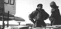
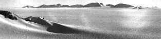
Loading a US Navy Dakota R4D propeller aircraft,
a DC3 modified for polar use, equipped with skis.

These aircraft ferried the expedition 640 km north
to the exploration area in Northern Victoria Land
on 4 December 1962.

Two planes carried the eight expedition members,
together with equipment and supplies for a two-month stay.

Four tents on the vast polar plateau.
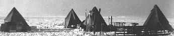
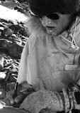
Freshly arrived at the polar plateau depôt, elevation 2400 m (8000 ft).
John Millen and Gerald Holdsworth each led a 4-man team.
This account mostly concerns Gerald’s team.

Millen Range from the aircraft landing place.
The Millen Range edges the polar plateau, a view from the depôt.
At left is Toboggan Gap, an hour's fast march away,
which both teams used as a route to the glaciers,
after some weeks exploring on the plateau.

Pharoah Nunatak is an island in the polar plateau ice
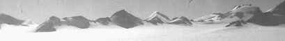
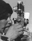
Pharaoh Nunatak, southwest across the plateau,
from survey station E2, a landmark on the Millen Range.

Sphinx Peak lies to the left, Pyramid to the right.
Gerald's team visited Pyramid almost a month later,
on the return leg of their polar plateau loop.

US Navy aircraft landed on this part of the plateau.
From station E2 south towards the depôt,
10 km away across the polar plateau,
visible only in binoculars or in the surveying theodolite.

Beyond at 28 km is Mt. Watt
(named for the expedition secretary, Brenda),
the southern limit of John Millen's team's route.

Gerald records soil characteristics. Gerald surveys landmarks using the theodolite. Gerald reaches camp after a long, cold day.
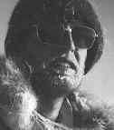
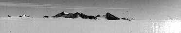
Gerald makes notes on soils (left),
surveys at station E2 (center),
and returns to the depôt after a 15-hour outing,
at a temperature of -34°C (right). 5 December.

Surveying and geology took up to eight hours or more at a station,
after a stiff climb to reach the lookout.

Exploration Area
Back to Antarctica
| Main Menu | Mount Pearson | Antarctic Expedition | | |
| Antarctica Ahoy! | Around Scott Base | Expedition Begins | Exploration Area | Exploration Routes |
| Plateau Loop Map | Polar Plateau | Icy Panorama | East Quartzite Range | West Quartzite Range |
| Upper Glacier | Glacier Route | Middle Glacier | Lower Glacier | Final Stretch |
| Destination | Conclusion | Diary: Introduction | Diary: Preparation | Diary: Polar Plateau |
| Diary: Quartzite Xmas | Diary: Into the Glacier | Diary: Home Run | Appendix: Polar Life | Appendix: Logistics |
| Appendix: Mapping | Acknowledgements
Last modified: Wed Mar 4 17:41:33 NZDT 2020
Best viewed at 1024x768 or above resolution.
© Copyright 1999-2020 Davin Pearson.
Please report any broken links to